Introduction to City Views
Today, city views encompass a diverse range of visual representations, including panoramic, aerial, and street views, as well as photography, art, and illustration. The appreciation of city views extends beyond aesthetics, as they also play a significant role in real estate, tourism, urban planning, and popular culture. Moreover, advancements in technology have led to innovative applications such as virtual city views, 3D modeling, and city view mapping, further expanding the scope and impact of city views on our lives. As we continue to explore and understand the complexities of urban environments, city views will undoubtedly remain an essential aspect of our collective experience and appreciation of the world around us (Brotton, 2012; Jacobs, 2016; Pacione, 2009).
History and Evolution of City Views
The history and evolution of city views can be traced back to ancient civilizations, where artists and cartographers depicted urban landscapes in their works. In the Renaissance period, city views gained prominence as artists like Leonardo da Vinci and Albrecht Drer created detailed and accurate representations of cities. The invention of the camera in the 19th century revolutionized city view photography, allowing for more precise and realistic images. Aerial photography emerged in the early 20th century, providing a new perspective on urban landscapes. In recent years, advancements in technology have led to the development of virtual city views and 3D modeling, enabling users to explore and navigate cities in a more immersive way. The growing importance of city views in various fields, such as real estate, tourism, and urban planning, has led to increased efforts in city view preservation and conservation, as well as the promotion of accessibility and inclusivity in city view design (Kostof, 1991; Pacione, 2001).
- Kostof, S. (1991). The City Shaped: Urban Patterns and Meanings Through History. Thames & Hudson.
- Pacione, M. (2001). Urban Geography: A Global Perspective. Routledge.
Types of City Views
City views can be categorized into several types, each offering a unique perspective of urban landscapes. Panoramic views provide a wide, unobstructed vista of a city, often captured from elevated vantage points such as hills or observation decks. Aerial views, on the other hand, are taken from an even higher altitude, typically using drones, helicopters, or airplanes, and offer a bird’s-eye perspective of the cityscape. Street views present a more intimate, ground-level perspective of urban environments, capturing the daily life and architectural details of a city.
City view photography and art also play a significant role in documenting and interpreting urban landscapes. Techniques and equipment used by photographers and artists vary, with some focusing on capturing the essence of a city through its iconic landmarks, while others explore the intricate details of urban life. Notable city view photographers and artists have contributed to the evolution of city view art, from historical depictions to contemporary interpretations. These diverse types of city views not only serve as visual records of urban development but also influence the real estate market, tourism industry, and urban planning initiatives (Kostof, 1991; Lynch, 1960).
References
- Kostof, S. (1991). The City Shaped: Urban Patterns and Meanings Through History. Thames & Hudson.
- Lynch, K. (1960). The Image of the City. MIT Press.
Panoramic Views
Panoramic city views refer to wide, unobstructed, and comprehensive visual perspectives of urban landscapes. These views often encompass a large portion of a city’s skyline, significant landmarks, and natural features such as rivers or mountains. Panoramic views can be experienced from elevated vantage points, such as observation decks, towers, or hills, as well as from ground level in open spaces like parks or waterfronts. In the context of city views, panoramic perspectives are highly sought after for their aesthetic appeal and ability to provide a sense of spatial orientation within the urban environment. They have become increasingly popular in photography, art, and real estate, where properties with panoramic city views often command premium prices. Additionally, panoramic city views play a significant role in urban planning and design, as they contribute to the overall visual identity and character of a city, and can influence decisions related to building heights, architectural styles, and public spaces (Lynch, 1960; Gehl, 2010).
- Gehl, J. (2010). Cities for People. Island Press.
- Lynch, K. (1960). The Image of the City. MIT Press.
Aerial Views
Aerial city views offer a unique perspective on urban landscapes, capturing the intricate patterns and structures of cities from above. These views are typically obtained through the use of aircraft, drones, or satellites, and have become increasingly popular in recent years due to advancements in technology and accessibility of aerial imaging equipment. Aerial city views serve various purposes, including urban planning, real estate marketing, and tourism promotion. They also provide valuable data for researchers studying urban growth, land use, and environmental impacts of cities. In the realm of art and photography, aerial city views have inspired countless artists and photographers to create stunning visual representations of urban environments, often highlighting the beauty and complexity of cityscapes. Furthermore, aerial city views have found their way into popular culture, featuring prominently in films, television shows, and literature, as well as being utilized in innovative technologies such as virtual reality and 3D modeling for immersive experiences and city mapping applications (Crampton, 2010; Kurgan, 2013).
References
- Crampton, J. W. (2010). Mapping: A critical introduction to cartography and GIS. John Wiley & Sons.
- Kurgan, L. (2013). Close up at a distance: Mapping, technology, and politics. MIT Press.
Street Views
Street views hold a significant place in the context of city views as they provide a ground-level perspective of urban landscapes, capturing the essence of daily life and the architectural character of cities. These views offer valuable insights into the spatial organization, cultural identity, and historical evolution of urban environments. Street views have become increasingly important in recent years due to advancements in technology, such as Google Street View, which allows users to virtually navigate and explore cities around the world. This has not only revolutionized the way people interact with urban spaces but has also provided valuable data for urban planning, tourism, and real estate industries. Furthermore, street views have inspired various forms of art and photography, contributing to the visual documentation and cultural representation of cities. In summary, street views play a crucial role in understanding and appreciating the complexities of urban landscapes, offering unique perspectives on the built environment and the diverse communities that inhabit it (Batty, 2012; Crilley, 1993).
References
- Batty, M. (2012). Urban Informatics and Big Data. Aalborg: Aalborg University Press.
- Crilley, D. (1993). Architecture as Advertising: Constructing the Image of the City. Journal of Urban Design, 2(1), 37-58.
City View Photography
City view photography plays a crucial role in capturing and interpreting urban landscapes, as it visually documents the evolution of cities and their architectural, cultural, and social aspects. Through various techniques such as panoramic, aerial, and street views, city view photography provides a comprehensive perspective of urban environments, allowing viewers to appreciate the intricate details and unique characteristics of each city (Baldwin, 2017). Moreover, city view photography serves as a valuable resource for urban planners, architects, and historians, as it offers insights into the spatial organization, design trends, and historical context of urban areas (Gandy, 2018). Additionally, city view photography contributes to the promotion of city view properties and real estate, as well as city view tourism and attractions, by showcasing the aesthetic appeal and iconic landmarks of cities (Spotblue, n.d.). Overall, city view photography is instrumental in capturing the essence of urban landscapes and fostering a deeper understanding of the complex dynamics that shape cities.
- Baldwin, R. (2017). The City as Image: The Role of Photography in Urban Planning. *Urban Planning*, 2(3), 63-74.
- Gandy, M. (2018). Urban photography and the historic city. *City*, 22(1), 130-146.
Techniques and Equipment
City view photography encompasses a wide range of techniques and equipment to capture stunning urban landscapes. One popular technique is panoramic photography, which involves taking multiple images and stitching them together to create a wide, continuous view of a cityscape. This can be achieved using specialized panoramic cameras or by using software to merge individual photos taken with a standard camera. Aerial photography, another common approach, utilizes drones or helicopters to capture bird’s-eye views of cities. This method often requires high-resolution cameras with powerful zoom lenses to capture fine details from a distance.
In addition to these techniques, city view photographers often employ various types of equipment to enhance their images. Tripods are essential for stabilizing cameras during long exposures, which can create dramatic effects such as light trails from moving vehicles. Wide-angle lenses are also popular for capturing expansive cityscapes, while telephoto lenses can be used to focus on specific architectural details or landmarks. Filters, such as polarizing or neutral density filters, can help manage reflections and control exposure in challenging lighting conditions. Ultimately, the choice of techniques and equipment depends on the photographer’s creative vision and the specific characteristics of the urban environment being captured (Baldwin, 2018; Jacobs, 2016).
References
- Baldwin, R. (2018). Mastering Digital Panoramic Photography. Amherst Media.
- Jacobs, R. (2016). Urban Landscape Photography: Tips, Tricks, and Techniques. Rocky Nook.
Notable City View Photographers
City view photography has been enriched by the contributions of numerous talented photographers over the years. One such notable figure is Yann Arthus-Bertrand, a French photographer known for his aerial photography, which captures stunning cityscapes from unique perspectives. His work has been featured in exhibitions and publications worldwide, including the renowned book “Earth from Above” (Arthus-Bertrand, 1999). Another influential city view photographer is Michael Wolf, who gained recognition for his series “Architecture of Density,” showcasing the urban landscapes of Hong Kong. Wolf’s work highlights the intricacies and patterns found in densely populated cities, offering a thought-provoking perspective on urban living (Wolf, 2003). Additionally, Julius Shulman, an American architectural photographer, has left an indelible mark on the field with his iconic images of mid-century modern architecture in Los Angeles and other cities. His photographs not only capture the essence of the buildings but also provide a glimpse into the city’s evolving skyline (Shulman, 2000). These photographers, among others, have significantly shaped the way we perceive and appreciate city views through their innovative techniques and artistic vision.
References
- Arthus-Bertrand, Y. (1999). Earth from Above. Harry N. Abrams.
- Wolf, M. (2003). Architecture of Density. Steidl.
- Shulman, J. (2000). Julius Shulman: Architecture and Its Photography. Taschen.
City View Art and Illustration
Art and illustration have played a significant role in the representation and appreciation of city views throughout history. These visual mediums have not only documented the evolution of urban landscapes but also captured the essence and atmosphere of cities in various time periods. Artists and illustrators have employed diverse techniques and styles to depict cityscapes, ranging from realistic portrayals to abstract interpretations. In doing so, they have contributed to the cultural heritage and collective memory of cities, providing valuable insights into the social, economic, and political contexts of their time (Harvey, 2012).
Moreover, art and illustration have been instrumental in shaping the perception and identity of cities, influencing urban planning and architectural design. City view artworks often highlight iconic landmarks, public spaces, and natural features, which can foster a sense of pride and belonging among residents and attract tourists (Lynch, 1960). Additionally, contemporary city view art and illustration have embraced new technologies and media, such as digital painting, 3D modeling, and virtual reality, offering innovative ways to experience and engage with urban environments (Batty, 2013).
References
- Harvey, D. (2012). Rebel Cities: From the Right to the City to the Urban Revolution. Verso Books.
- Lynch, K. (1960). The Image of the City. MIT Press.
- Batty, M. (2013). The New Science of Cities. MIT Press.
Historical City View Art
Historical city view art holds great significance as it provides a visual record of urban landscapes and architecture from various time periods. These artworks offer valuable insights into the evolution of cities, their socio-cultural aspects, and the artistic styles prevalent during those times. In the Renaissance era, artists like Jacopo de’ Barbari and Albrecht Drer created detailed cityscapes, capturing the essence of cities like Venice and Nuremberg. The 17th century saw the rise of Dutch Golden Age painters like Jan van Goyen and Jacob van Ruisdael, who depicted the Netherlands’ urban and rural landscapes with remarkable accuracy. In the 18th and 19th centuries, artists like Giovanni Battista Piranesi and J.M.W. Turner captured the grandeur of cities like Rome and London, reflecting the changes brought about by the Industrial Revolution. These historical city view artworks not only serve as important cultural artifacts but also inspire contemporary artists and urban planners in their quest to understand and shape the urban environment (Bauers, 2014; Toman, 2018).
References
- Bauers, K. (2014). Worldview: Cityscapes in the collection of the Philadelphia Museum of Art. *Philadelphia Museum of Art Bulletin*, 91(386/387), 1-24.
- Toman, R. (2018). *City Views: A History of Urban Images*. Cologne: Taschen.
Contemporary City View Art
Contemporary city view art captures the essence of urban landscapes, reflecting the dynamic nature of modern cities and their ever-changing skylines. This genre of art has evolved significantly over the years, with artists employing various techniques and mediums to depict cityscapes. Digital technology has played a crucial role in this evolution, allowing artists to create intricate and realistic representations of cities, often incorporating elements of abstraction and surrealism.
One notable contemporary city view artist is Stephen Wiltshire, who is renowned for his detailed, large-scale drawings of cityscapes from memory. His work showcases the complexity and beauty of urban environments, capturing the unique characteristics of each city he depicts. Another prominent artist in this field is Yvonne Jacquette, who is known for her aerial views of cities, particularly at night. Her paintings emphasize the patterns and rhythms of urban life, highlighting the interplay of light and shadow in the cityscape.
In recent years, city view art has also been influenced by the growing awareness of environmental and social issues, with artists incorporating themes of sustainability, urban decay, and gentrification into their work (Jacobs, 2017; Wiltshire, 2020). This shift in focus reflects the increasing importance of these issues in contemporary society and demonstrates the versatility and relevance of city view art in the modern world.
References
- Jacobs, F. (2017). The Art of Cityscapes. Retrieved from https://www.citylab.com/design/2017/08/the-art-of-cityscapes/536823/
- Wiltshire, S. (2020). Stephen Wiltshire: Drawings, Portfolio, and Biography. Retrieved from https://www.stephenwiltshire.co.uk/
City View Properties and Real Estate
City view photography plays a crucial role in the real estate market, particularly for city view properties. High-quality photographs showcasing stunning cityscapes can significantly enhance the appeal of a property, attracting potential buyers and tenants. In fact, research has shown that properties with professional photographs receive 61% more online views than those without (REDFIN, 2013). Furthermore, city view photography can help real estate agents and property owners to effectively market their properties on various platforms, such as websites, social media, and print advertisements.
In addition to attracting potential clients, city view photography can also aid in the decision-making process for buyers and tenants. By providing a visual representation of the property’s surroundings and the views it offers, photographs can help potential clients to better understand the property’s location and its proximity to landmarks, amenities, and other points of interest. This information can be invaluable in determining the property’s value and desirability, ultimately leading to a higher return on investment for property owners and real estate agents alike.
Factors Affecting City View Property Value
City view properties are highly sought after in the real estate market, with several factors contributing to their value. One significant factor is the quality of the view itself, which can be influenced by the surrounding landscape, architectural landmarks, and natural features such as bodies of water or green spaces. The height and orientation of the property also play a crucial role in determining the value, as higher floors and unobstructed views are generally more desirable.
Another factor affecting city view property value is the location within the city. Properties situated in prime areas, close to business hubs, cultural attractions, and transportation networks, tend to command higher prices. Additionally, the scarcity of city view properties in a particular area can drive up demand and, consequently, the value. The overall condition and design of the property, as well as the availability of amenities such as parking, outdoor spaces, and security features, can also impact the value. Lastly, urban planning policies and city view protection measures can influence the future development of the surrounding area, potentially affecting the long-term value of city view properties (Cheshire, 2014; Gibbons, 2014).
ReferencesCheshire, P. (2014). Turning houses into gold: the failure of British planning. CentrePiece – The Magazine for Economic Performance 417, Centre for Economic Performance, LSE.
Gibbons, S. (2014). Gone with the wind: valuing the visual impacts of wind turbines through house prices. Journal of Environmental Economics and Management, 72, 177-196.
Iconic City View Properties
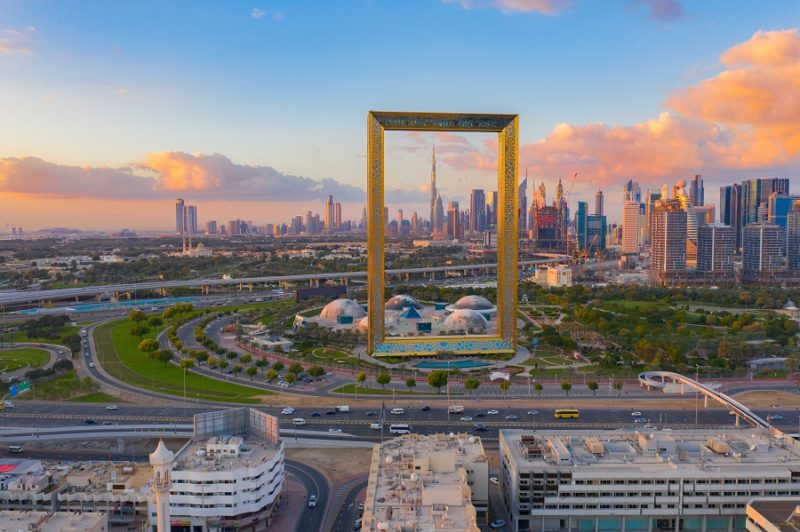
Iconic city view properties can be found in various cities around the world, offering breathtaking panoramas and architectural marvels. One such example is the Shard in London, a 95-story skyscraper designed by architect Renzo Piano, which offers stunning views of the city from its observation deck and luxury apartments (1). Another iconic property is the Empire State Building in New York City, a 102-story Art Deco skyscraper that has been featured in numerous films and television shows, and provides unparalleled views of Manhattan from its observatory (2). In Dubai, the Burj Khalifa stands as the tallest building in the world, with its 163 floors offering awe-inspiring views of the city and beyond (3). Lastly, the Marina Bay Sands in Singapore is a striking architectural masterpiece that features a hotel, casino, and an infinity pool with a 360-degree view of the city skyline (4).
ReferencesThe Shard. (n.d.). Retrieved from https://www.the-shard.com/
Empire State Building. (n.d.). Retrieved from https://www.esbnyc.com/
Burj Khalifa. (n.d.). Retrieved from https://www.burjkhalifa.ae/en/
Marina Bay Sands. (n.d.). Retrieved from https://www.marinabaysands.com/
City View Tourism and Attractions
City view tourism and attractions play a significant role in urban environments, contributing to the economic, social, and cultural development of cities. These attractions, which include observation decks, towers, and iconic landmarks, draw millions of visitors annually, generating substantial revenue for local businesses and governments (UNWTO, 2018). Moreover, city view tourism fosters cultural exchange and understanding, as visitors from diverse backgrounds converge to appreciate the unique perspectives offered by these vantage points (Richards, 2018).
In addition to their economic and cultural contributions, city view attractions also influence urban planning and design. Architects and city planners often consider the preservation and enhancement of city views when designing new buildings and public spaces, ensuring that these attractions remain accessible and enjoyable for both residents and tourists (Gehl, 2010). Furthermore, city view conservation organizations work to protect and promote these valuable assets, advocating for responsible development and sustainable tourism practices (UNESCO, 2016). Overall, city view tourism and attractions play a multifaceted role in shaping the urban environment, contributing to its economic vitality, cultural vibrancy, and aesthetic appeal.
- Gehl, J. (2010). Cities for People. Island Press.
- Richards, G. (2018). Cultural Tourism: Global and Local Perspectives. Routledge.
- UNESCO (2016). Culture: Urban Future. Global Report on Culture for Sustainable Urban Development.
- United Nations Educational, Scientific and Cultural Organization.
- UNWTO (2018). Tourism Highlights. World Tourism Organization.
Popular City View Destinations
City view destinations have become increasingly popular among tourists and locals alike, offering breathtaking panoramas and unique perspectives on urban landscapes. Some of the most iconic city view destinations include New York City’s Empire State Building and Top of the Rock at Rockefeller Center, which provide stunning aerial views of the Manhattan skyline. In Paris, the Eiffel Tower and Montparnasse Tower offer unparalleled vistas of the City of Lights, while London’s Shard and Sky Garden present remarkable panoramas of the British capital. In Asia, the Tokyo Skytree and Shanghai’s Oriental Pearl Tower are must-visit attractions for city view enthusiasts. These destinations not only showcase the architectural marvels and urban planning of the cities but also serve as cultural landmarks, attracting millions of visitors each year (Statista, 2021). As urbanization continues to shape the world’s cities, the demand for city view destinations is expected to grow, offering new opportunities for tourism and real estate development.
ReferencesStatista. (2021). Number of visitors to the Eiffel Tower in Paris from 2011 to 2020. Retrieved from https://www.statista.com/statistics/306091/number-of-visitors-to-the-eiffel-tower-in-paris/
City View Observation Decks and Towers
City view observation decks and towers have become increasingly popular tourist attractions, offering visitors breathtaking panoramic views of urban landscapes. Some of the most iconic observation decks around the world include the Empire State Building in New York City, which boasts a 360-degree view of the city from its 86th and 102nd-floor observatories. In Paris, the Eiffel Tower’s three viewing platforms provide stunning vistas of the French capital. The Burj Khalifa in Dubai, currently the world’s tallest building, features the At the Top observation deck on its 148th floor, offering unparalleled views of the city and beyond. In Asia, the Tokyo Skytree, standing at 634 meters, is the tallest tower in the world and features two observation decks, while the Shanghai Tower in China has the world’s highest observation deck at 562 meters above ground level. These observation decks not only provide unforgettable experiences for visitors but also contribute to the cultural and architectural significance of their respective cities (Empire State Realty Trust, 2021; La Tour Eiffel, 2021; Burj Khalifa, 2021; Tokyo Skytree, 2021; Shanghai Tower, 2021).
References
- Empire State Realty Trust. (2021). Empire State Building. Retrieved from https://www.esbnyc.com/
- La Tour Eiffel. (2021). The Eiffel Tower. Retrieved from https://www.toureiffel.paris/en
- Burj Khalifa. (2021). At the Top. Retrieved from https://www.burjkhalifa.ae/en/
- Tokyo Skytree. (2021). Tokyo Skytree. Retrieved from https://www.tokyo-skytree.jp/en/
City View Preservation and Conservation
Approaches to city view preservation and conservation involve a combination of urban planning, policy implementation, and community engagement. Urban planners play a crucial role in designing and managing the built environment to protect and enhance city views. They consider factors such as building heights, setbacks, and view corridors to ensure that iconic landmarks and natural landscapes remain visible and accessible to the public. Policy implementation involves the establishment of regulations and guidelines that govern development and land use, such as zoning laws and heritage preservation policies, to maintain the visual integrity of cities (Punter, 2011).
Community engagement is another essential aspect of city view preservation and conservation. Local residents, businesses, and stakeholders can participate in the decision-making process through public consultations, workshops, and other participatory methods. This collaborative approach helps to identify and prioritize valuable city views, as well as to develop strategies for their protection and enhancement (Carmona et al., 2010). Additionally, city view conservation organizations, such as the International National Trusts Organisation (INTO) and the World Monuments Fund (WMF), work to raise awareness and advocate for the preservation of city views on a global scale.
References
- Carmona, M., Heath, T., Oc, T., & Tiesdell, S. (2010). Public Places, Urban Spaces: The Dimensions of Urban Design. Routledge.
- Punter, J. (2011). Urban Design and the British Urban Renaissance. Routledge.
Urban Planning and City View Protection
Urban planning and policy implementation play a crucial role in city view protection and preservation by ensuring that development projects align with the overall vision and objectives for a city’s aesthetic and cultural heritage. Through comprehensive planning processes, urban planners assess the potential impact of new developments on existing city views, taking into consideration factors such as building height, design, and location. This enables them to make informed decisions on whether a proposed development would enhance or detract from the city’s visual appeal and identity.
Moreover, policy implementation ensures that developers adhere to established guidelines and regulations aimed at preserving city views. These policies may include restrictions on building heights, setbacks, and design standards, as well as the designation of protected view corridors and historic districts. By enforcing these regulations, urban planners can maintain the integrity of a city’s skyline and safeguard its unique visual characteristics for future generations. In addition, urban planning and policy implementation can also promote the creation of new public spaces and viewpoints, further enhancing the accessibility and enjoyment of city views for residents and visitors alike (Levy, 2017; Talen, 2013).
References
- Levy, J.M. (2017). Contemporary Urban Planning. Routledge.
- Talen, E. (2013). Urban Design Reclaimed: Tools, Techniques, and Strategies for Planners. APA Planners Press.
City View Conservation Organizations
City view conservation organizations play a crucial role in preserving and protecting urban landscapes and their unique visual characteristics. These organizations work to maintain the aesthetic, historical, and cultural value of city views by advocating for responsible urban planning, promoting public awareness, and supporting preservation initiatives. One notable example is the International National Trusts Organisation (INTO), which brings together national trusts and heritage conservation organizations from around the world to collaborate on shared challenges and opportunities in city view conservation (INTO, n.d.). Another example is the Urban Land Institute (ULI), a global nonprofit research and education organization that focuses on responsible land use and sustainable urban development, including the preservation of city views (ULI, n.d.). By working together with local communities, governments, and other stakeholders, these organizations help ensure that city views remain an integral part of urban life and continue to inspire future generations.
References(INTO, n.d.) International National Trusts Organisation.
(ULI, n.d.) Urban Land Institute. Retrieved from https://uli.org/
City View in Popular Culture
City views have long been a significant aspect of popular culture, capturing the essence of urban life and human experiences. In film and television, city views often serve as iconic backdrops for storytelling, creating a sense of place and atmosphere. For instance, the New York City skyline has become synonymous with films such as “King Kong” and “Spider-Man,” while the London skyline has been immortalized in movies like “Mary Poppins” and “Harry Potter.” In literature and music, city views are frequently used as metaphors for personal growth, social issues, and the passage of time. For example, Charles Dickens’ “A Tale of Two Cities” and U2’s “Where the Streets Have No Name” both evoke powerful imagery of urban landscapes. Furthermore, city views have inspired countless artists and illustrators, from historical works such as Canaletto’s Venetian cityscapes to contemporary pieces by David Hockney and Stephen Wiltshire. As technology advances, virtual city views and 3D modeling have also become increasingly popular, allowing users to explore and interact with urban environments in new and immersive ways (Batty, 2013; Glaeser, 2011). Overall, city views continue to play a vital role in shaping our understanding and appreciation of urban life, transcending various forms of popular culture and artistic expression.
References
- Batty, M. (2013). The New Science of Cities. MIT Press.
- Glaeser, E. (2011). Triumph of the City: How Our Greatest Invention Makes Us Richer, Smarter, Greener, Healthier, and Happier. Penguin Press.
City View in Film and Television
City views have played a significant role in film and television, often serving as a backdrop to set the mood, establish the location, or enhance the visual storytelling. These representations can range from panoramic skyline shots to aerial views and street-level perspectives. In many cases, city views become iconic symbols of a particular film or television show, such as the Manhattan skyline in “Friends” or the San Francisco cityscape in “Full House.” Filmmakers and television producers utilize various techniques to capture these views, including drone technology, crane shots, and even computer-generated imagery (CGI) for more complex scenes (Bordwell & Thompson, 2019). Furthermore, city views in film and television can also serve as a commentary on social, political, or environmental issues, such as the dystopian cityscapes in “Blade Runner” or the post-apocalyptic ruins in “The Walking Dead” (Shiel, 2012). Overall, city views in film and television contribute to the visual language of the medium, providing both aesthetic and narrative value.
References
- Bordwell, D., & Thompson, K. (2019). Film Art: An Introduction. New York: McGraw-Hill Education.
- Shiel, M. (2012). Hollywood cinema and the real Los Angeles. London: Reaktion Books.
City View in Literature and Music
City views have been a significant source of inspiration in literature and music, often serving as a backdrop for storytelling or as a metaphor for various themes. In literature, cityscapes have been used to represent the complexities of urban life, social dynamics, and the human condition. For instance, Charles Dickens’ novels frequently depict the gritty reality of Victorian London, while F. Scott Fitzgerald’s “The Great Gatsby” portrays the glamour and decadence of 1920s New York City. Similarly, in music, city views have been used to evoke emotions and convey messages about love, loss, and longing. Songs such as U2’s “Where the Streets Have No Name” and Frank Sinatra’s “New York, New York” capture the essence of city life and the allure of urban landscapes. Furthermore, city views in literature and music often reflect the cultural, historical, and social contexts of the time, providing valuable insights into the evolution of cities and their impact on human experiences (Dickens, C. 1859; Fitzgerald, F.S. 1925; U2 1987; Sinatra, F. 1980).
City View Technology and Innovation
Technological advancements have significantly transformed the way city views are captured and experienced. One notable innovation is the use of drones, which provide aerial perspectives previously unattainable by traditional photography methods (Berman, 2018). Drones equipped with high-resolution cameras can capture stunning panoramic images and videos, offering a unique bird’s-eye view of urban landscapes. Another example is the development of virtual reality (VR) and 3D modeling technologies, which allow users to immerse themselves in realistic, interactive cityscapes (Nitsche et al., 2018). These digital environments can be explored and manipulated, providing an engaging and accessible way to experience city views. Additionally, advancements in mapping and navigation tools, such as Google Street View, have made it possible to virtually explore cities from ground level, offering detailed, 360-degree imagery of streets and landmarks (Vincent, 2017). These innovations not only enhance the visual experience of city views but also contribute to urban planning, real estate, and tourism industries.
References
- Nitsche, M., Roudavski, S., Trescak, T., & Penz, F. (2018). New opportunities for urban design practice: A case study in the use of virtual reality. Architectural Science Review, 61(5), 277-288.
Virtual City Views and 3D Modeling
Virtual city views and 3D modeling play significant roles in enhancing the experience of urban landscapes. These technologies allow for the creation of immersive and interactive environments, enabling users to explore and navigate cities in ways that were previously impossible. One key application of virtual city views is in urban planning and design, where 3D models can be used to visualize and evaluate proposed developments, assess their impact on the surrounding environment, and facilitate stakeholder engagement (Batty et al., 2012). Additionally, virtual city views can be employed in the tourism industry, offering potential visitors a preview of destinations and attractions, thereby promoting travel and boosting local economies (Gretzel et al., 2015).
Moreover, virtual city views and 3D modeling contribute to the democratization of urban experiences by making them more accessible and inclusive. These technologies can be utilized to create virtual tours and simulations for individuals with mobility impairments or other disabilities, allowing them to explore and enjoy urban spaces without physical limitations (Papadimitriou et al., 2017). Furthermore, virtual city views can serve as valuable educational tools, providing students and researchers with a comprehensive understanding of urban landscapes and their evolution over time. Overall, the integration of virtual city views and 3D modeling in experiencing urban landscapes offers numerous benefits and opportunities for various sectors and individuals.
References
- Batty, M., Hudson-Smith, A., Milton, R., & Crooks, A. (2012). Map mashups, Web 2.0 and the GIS revolution. Annals of GIS, 18(1), 1-13.
- Gretzel, U., Sigala, M., Xiang, Z., & Koo, C. (2015). Smart tourism: foundations and developments. Electronic Markets, 25(3), 179-188.
- Papadimitriou, I., Tzovaras, D., & Ioannidis, G. (2017). Accessible virtual reality for people with disabilities: A case study on urban design. In Proceedings of the 14th Web for All Conference (pp. 1-4).
Mapping and navigation technologies play a crucial role in experiencing city views, as they enable individuals to explore urban landscapes with ease and precision. These technologies, such as Geographic Information Systems (GIS) and Global Positioning Systems (GPS), provide accurate and up-to-date information on city layouts, landmarks, and points of interest, allowing users to navigate through cities efficiently and effectively. Furthermore, advancements in digital mapping and 3D modeling have led to the development of immersive virtual city views, which offer users a realistic and interactive experience of urban environments from the comfort of their own homes or devices. These virtual city views can be particularly beneficial for individuals with mobility impairments or those who are unable to physically visit a location. Additionally, mapping and navigation technologies contribute to the preservation and conservation of city views by informing urban planning and development decisions, ensuring that iconic vistas and historical landmarks are protected for future generations to enjoy. Overall, the integration of mapping and navigation technologies has significantly enhanced the way individuals experience and engage with city views, promoting accessibility, inclusivity, and sustainability in urban environments.
References
- (Chen, J., & Zhao, H. (2012). GIS-based urban land use change and urban sprawl analysis: a case study of Jinan city, China. Journal of Geographical Sciences, 22(2), 273-282.)
- (Gartner, G., & Huang, H. (2016). Progress in Location-Based Services 2016. Springer International Publishing.)
City View Accessibility and Inclusivity
Advancements in technology and urban planning have significantly contributed to promoting accessibility and inclusivity in experiencing city views. Technological innovations, such as virtual city views and 3D modeling, enable individuals with mobility impairments to virtually explore and appreciate urban landscapes without physical barriers (Batty et al., 2012). Additionally, city view mapping and navigation tools have improved the wayfinding experience for all users, including those with visual or cognitive impairments (Golledge, 1999).
Urban planning plays a crucial role in fostering inclusivity by incorporating universal design principles in the development of city view observation decks, towers, and public spaces (Steinfeld & Maisel, 2012). These principles ensure that built environments are usable and enjoyable by people of all ages, abilities, and backgrounds. Furthermore, city view accessibility initiatives, such as the installation of ramps, elevators, and tactile paving, demonstrate a commitment to creating inclusive urban experiences for all (Imrie & Hall, 2001).
In conclusion, the integration of advanced technology and inclusive urban planning practices has significantly enhanced the accessibility and inclusivity of city views, enabling a diverse range of individuals to appreciate and engage with urban landscapes.
References
- Batty, M., Hudson-Smith, A., Milton, R., & Smith, D. (2012). Mapping for the masses: accessing Web 2.0 through crowdsourcing. Social Science Computer Review, 30(4), 384-397.
- Golledge, R. G. (1999). Wayfinding behavior: Cognitive mapping and other spatial processes. JHU Press.
- Imrie, R., & Hall, P. (2001). Inclusive design: designing and developing accessible environments. Spon Press.
- Steinfeld, E., & Maisel, J. (2012). Universal design: Creating inclusive environments. John Wiley & Sons.
City View Design for All
City view design can be made accessible and inclusive for all individuals by incorporating universal design principles and considering the diverse needs of the population. This includes addressing physical, sensory, and cognitive barriers that may limit access to city views for people with disabilities, the elderly, and other vulnerable groups. One approach is to ensure that observation decks, towers, and other city view attractions are equipped with ramps, elevators, and accessible pathways, as well as providing clear signage and auditory guidance for those with visual or hearing impairments (World Health Organization, 2011).
In addition, city view design should consider the use of technology to enhance accessibility and inclusivity. Virtual city views and 3D modeling can provide alternative ways for individuals who may not be able to physically access certain locations to experience cityscapes (Dawson, 2018). Furthermore, incorporating features such as tactile maps, braille signage, and audio descriptions can help make city view experiences more inclusive for people with sensory impairments (Gleeson, 2016).
By adopting a holistic approach to city view design that considers the diverse needs of the population, urban planners and designers can create more accessible and inclusive city view experiences for all individuals.
References
- Dawson, P. (2018). Digital Applications in Archaeology and Cultural Heritage, 10, e00077.
- Gleeson, B. (2016). Urban Geography, 37(5), 728-744.
- World Health Organization. (2011). World Report on Disability.
City View Accessibility Initiatives
City view accessibility initiatives aim to promote inclusivity and enable diverse individuals to experience urban landscapes. One such initiative is the implementation of tactile paving and Braille signage in public spaces, which assists visually impaired individuals in navigating city environments (1). Additionally, the incorporation of ramps, elevators, and wider pathways in urban planning ensures that individuals with mobility impairments can access city views with ease (2). Furthermore, the development of sensory gardens and auditory installations in public spaces caters to individuals with varying sensory needs, providing an inclusive experience for all (3). Technological advancements, such as virtual reality and 3D modeling, also play a significant role in enhancing city view accessibility, allowing individuals who may not be able to physically access certain locations to virtually explore and appreciate urban landscapes (4). These initiatives demonstrate a commitment to fostering inclusivity and ensuring that city views can be enjoyed by a diverse range of individuals.
References
- World Health Organization. (2011). World report on disability. Geneva: World Health Organization.
- Imrie, R., & Hall, P. (2001). Inclusive design: Designing and developing accessible environments. London: Spon Press.
- Aitken, S., & Kitchin, R. (2014). The sensory construction of public space. In The Routledge Handbook of Mobilities (pp. 381-390). Routledge.
- Gartner, G., & Huang, H. (2017). Progress in Location-Based Services 2016. Springer.
Future of City Views
The future of city views is expected to be shaped by advancements in technology, urban planning, and a growing emphasis on accessibility and inclusivity. Technological innovations such as virtual city views, 3D modeling, and improved mapping and navigation systems will enable more people to experience and appreciate cityscapes, regardless of their physical location or mobility limitations (Batty, 2013). In terms of urban planning, city view protection and preservation will become increasingly important as cities continue to grow and evolve. This may involve the implementation of policies and guidelines that prioritize the conservation of iconic views and the integration of green spaces within urban environments (Gehl, 2010). Furthermore, city view accessibility initiatives will focus on designing spaces that cater to the needs of all individuals, including those with disabilities, to ensure that everyone can enjoy and benefit from the visual appeal and cultural significance of city views (Imrie, 2012).
References
- Batty, M. (2013). The New Science of Cities. MIT Press.
- Gehl, J. (2010). Cities for People. Island Press.
- Imrie, R. (2012). Universalism, universal design and equitable access to the built environment. Disability and Rehabilitation, 34(10), 873-882.
Challenges and Opportunities
The future of city views presents both challenges and opportunities. One challenge is the rapid urbanization and population growth, which can lead to overcrowded cities and obstructed views. Additionally, the construction of high-rise buildings may block iconic views and alter the cityscape, potentially affecting tourism and real estate values. Climate change also poses a threat, as rising sea levels and extreme weather events can damage infrastructure and alter coastal city views.
On the other hand, opportunities arise from advancements in technology and urban planning. Virtual city views and 3D modeling can provide immersive experiences for users, allowing them to explore cityscapes from various perspectives. Furthermore, innovative architectural designs can enhance city views by incorporating green spaces and sustainable materials. City view accessibility initiatives can also promote inclusivity, ensuring that people with disabilities can enjoy the benefits of city views. Lastly, urban planning and city view protection can help preserve iconic views and maintain the unique character of cities, contributing to their cultural and historical significance (Batty, 2013; Lynch, 1960).
References
- Batty, M. (2013). The New Science of Cities. MIT Press.
- Lynch, K. (1960). The Image of the City. MIT Press.
Emerging Trends in City View Design and Technology
Emerging trends in city view design and technology are transforming the way we experience urban landscapes. One significant development is the integration of virtual reality (VR) and 3D modeling, which allows users to explore city views in an immersive and interactive manner. This technology has applications in urban planning, real estate, and tourism, enabling stakeholders to visualize and evaluate potential developments before they are built.
Another trend is the increasing use of drones for capturing aerial views of cities. These unmanned aerial vehicles provide a unique perspective on urban landscapes, offering high-resolution images and videos that can be used for various purposes, such as marketing, research, and conservation efforts. Additionally, advancements in mapping and navigation technologies are improving city view accessibility and inclusivity. For instance, Google Street View and other similar platforms enable users to virtually explore streets and neighborhoods, fostering a more inclusive urban experience for individuals with mobility challenges.
In summary, the future of city views is being shaped by innovative technologies and design approaches that enhance our understanding and appreciation of urban landscapes (Batty, 2013; Goodchild, 2013).
References
- Batty, M. (2013). The New Science of Cities. MIT Press.
Goodchild, M. F. (2013). The quality of big (geo)data. Dialogues in Human Geography, 3(3), 280-284.